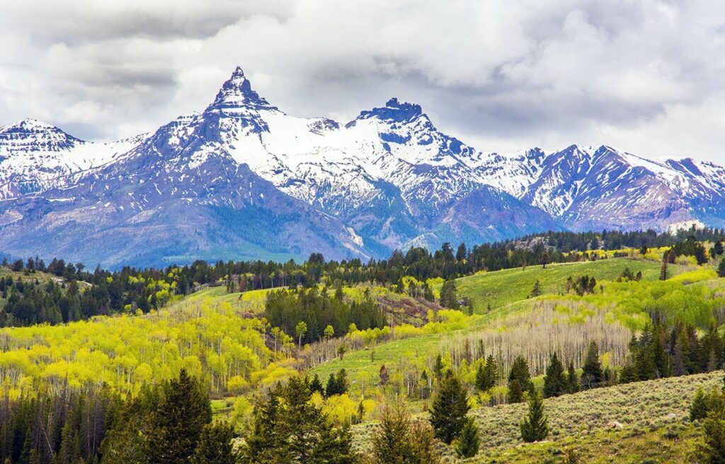
Between 50 and 60 million years ago, a massive uplift created the Beartooth Plateau. At roughly 3,000 square miles, the Beartooth Plateau is one of North America’s largest land masses rising above 10,000 feet, reaching its highest point at 12,799-ft. Granite Peak. This is a land of glacier-carved cirques, high alpine lakes and fragile tundra. The plateau, part of the Absaroka Beartooth Wilderness, is know simply as the Beartooths.
The Beartooth Highway
The Beartooth Highway is probably the best-known feature of the Beartooth Mountains. The Beartooth Highway is the section of US 212 that winds through Beartooth Pass to Cooke City and through the northeast gate of Yellowstone National Park.
The highway was built in the 1930s and is considered an engineering feat–even by today’s standards. The 68-mile road hugs the mountain-side along curving switchbacks that traverse up, across and back down the alpine plateau.
Hiking
Access to the Absaroka-Beartooth Wilderness Area is excellent. Numerous roads flank the wilderness area and in a few cases parallel the border. A few other roads, such as south of Big Timber, actually penetrate into the wilderness area (the boundary is on either side of the road). All these roads allow hikers a wide variety of places of access points and places to hike.
An example of just two of the many hiking trails follows:
- Bannock Trail
The Bannock Trail is an excellent trail for individuals of all ages. It is a short portion of the Bannock Indian route used to reach buffalo hunting grounds. Beginning at the small community of Silver Gate Montana the almost level terrain parallels Soda Butte Creek, a major tributary of the Lamar River, into Yellowstone National Park. The trail crosses several streams through open meadows and forest groves. This trail is best hiked from May to mid-October.
Total Distance – 4.8 miles
Elevation gain – 130 feet
Trail Type – Out and Back
Skill Level – Easy to Moderate - Corral Creek Trail
Beginning near the town of Red Lodge, the Corral Creek Trail follows a narrow mountain drainage curving around Sheridan Point. The trail leads to the headwaters of Corral Creek on the Line Creek Plateau. The well-defined trail has five creek crossings in the first mile. It is a beautiful but strenuous hike, gaining more than 3,000 feet.
Total Distance – 8 miles
Elevation gain – 3200 feet
Trail Type – Out and Back
Skill Level – Moderate to Strenuous
Camping
Camping in or around the wilderness area is also excellent. Many designated campgrounds, combined with virtually unlimited informal campsites, provide for plenty of places for camping, whether it is for a night or for a week.
Getting Here
If you are visiting either Yellowstone National Park or Cody Wyoming, you will venture into the Beartooth Mountains as you continue to travel north. Both routes will eventually take you to Cooke City, Montana.